
ABOUT US
(MALAYSIA · BORNEO)
(SCROLL DOWN)
OFO Borneo is a certified drone service provider delivering high-precision aerial mapping, 3D modeling, and inspection for construction, oil & gas, and infrastructure clients.
We combine field-proven flight operations with rigorous data processing to turn the sky into accurate, decision-ready intelligence.
(WHO WE ARE)
A Bornean drone team turning the sky into precise, decision-ready data.

(OUR STORY)
OFO Borneo was founded to bring world-class aerial intelligence to projects across Malaysia and the wider Borneo region. What began as a small team of certified pilots and surveyors has grown into a trusted partner for construction, oil & gas, and infrastructure clients who need accurate data they can act on.
We specialise in high-precision 2D mapping, 3D modeling, GIS analysis, and aerial inspection. Every engagement combines field-proven flight operations with rigorous data processing, so the deliverable you receive is not just imagery — it is insight your teams can plan, build, and maintain with.
Our work is guided by three principles: accuracy in every measurement, safety in every flight, and clarity in every report. That discipline is why clients return to us for their most demanding sites.
0+
Projects Delivered
0+
Hectares Mapped
0+
Flight Hours Logged
0+
Years of Operation
(CERTIFICATIONS & COMPLIANCE)
Flown by the book, so you can trust the data.
CAAM Certified Operations
All flights are conducted under Civil Aviation Authority of Malaysia (CAAM) regulations, with current operator authorisation and per-mission approvals where required.
Licensed Remote Pilots
Our crew holds valid Remote Pilot Licences and recurrent training records, ensuring every mission is flown by a qualified, current pilot.
Comprehensive Insurance
Operations are covered by public liability and equipment insurance, protecting your site, your people, and your project throughout the engagement.
Documented Safety Protocols
Every flight follows a standardised risk assessment, site briefing, and pre-flight checklist, backed by a clean safety record.
Data Security & Confidentiality
Survey data is handled under strict confidentiality, with secure storage and controlled delivery for sensitive industrial and infrastructure sites.
Quality-Assured Deliverables
Outputs are validated against survey-grade accuracy standards and checked before release, so the data you receive is reliable.
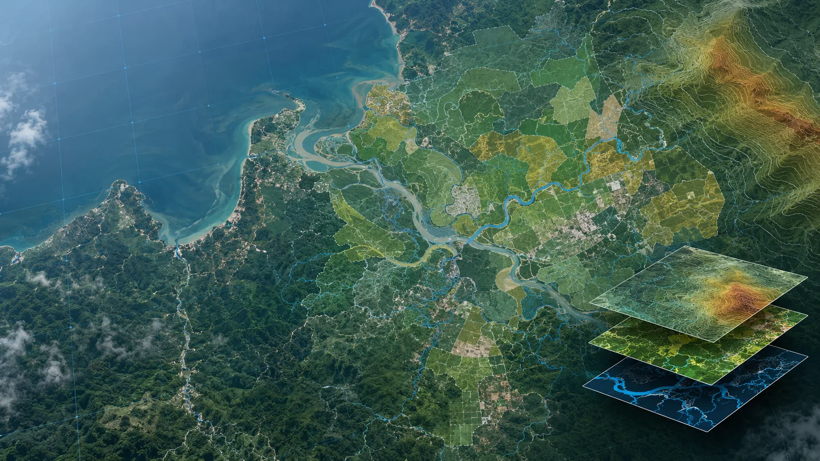
(WHAT WE DO)
Six capabilities, one accountable team.
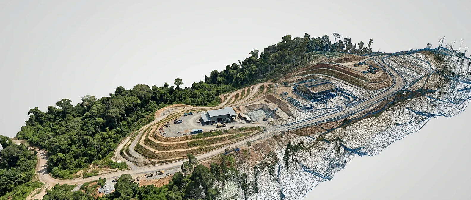
(EQUIPMENT & TECHNOLOGY)
The right platform for every payload.
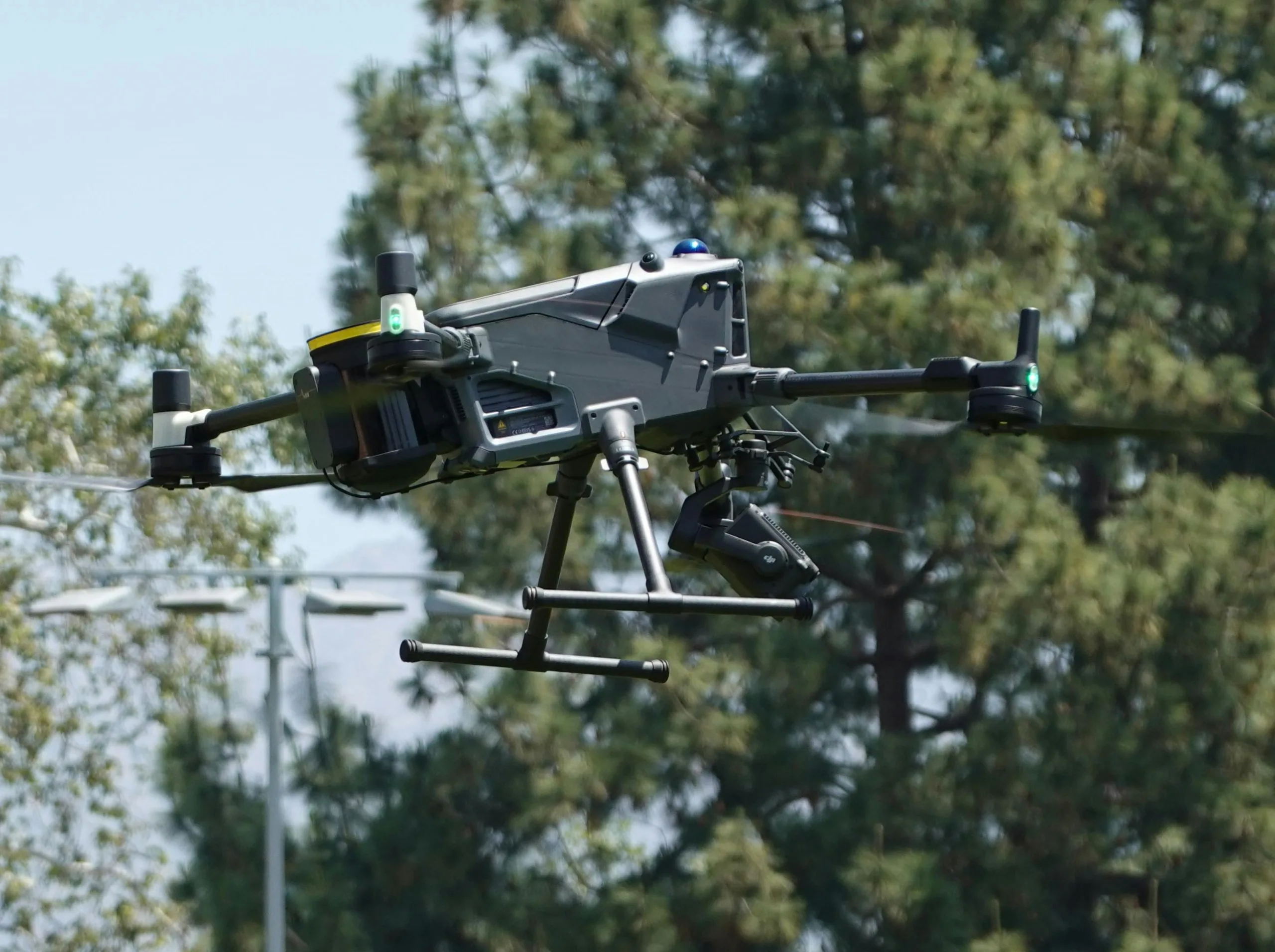
Survey-Grade Drone Fleet
Professional multirotor and fixed-wing platforms selected for stability, endurance, and payload flexibility across mapping and inspection missions.
High-Resolution Sensors
Full-frame photogrammetry cameras paired with LiDAR and thermal payloads to capture the right data for each deliverable.
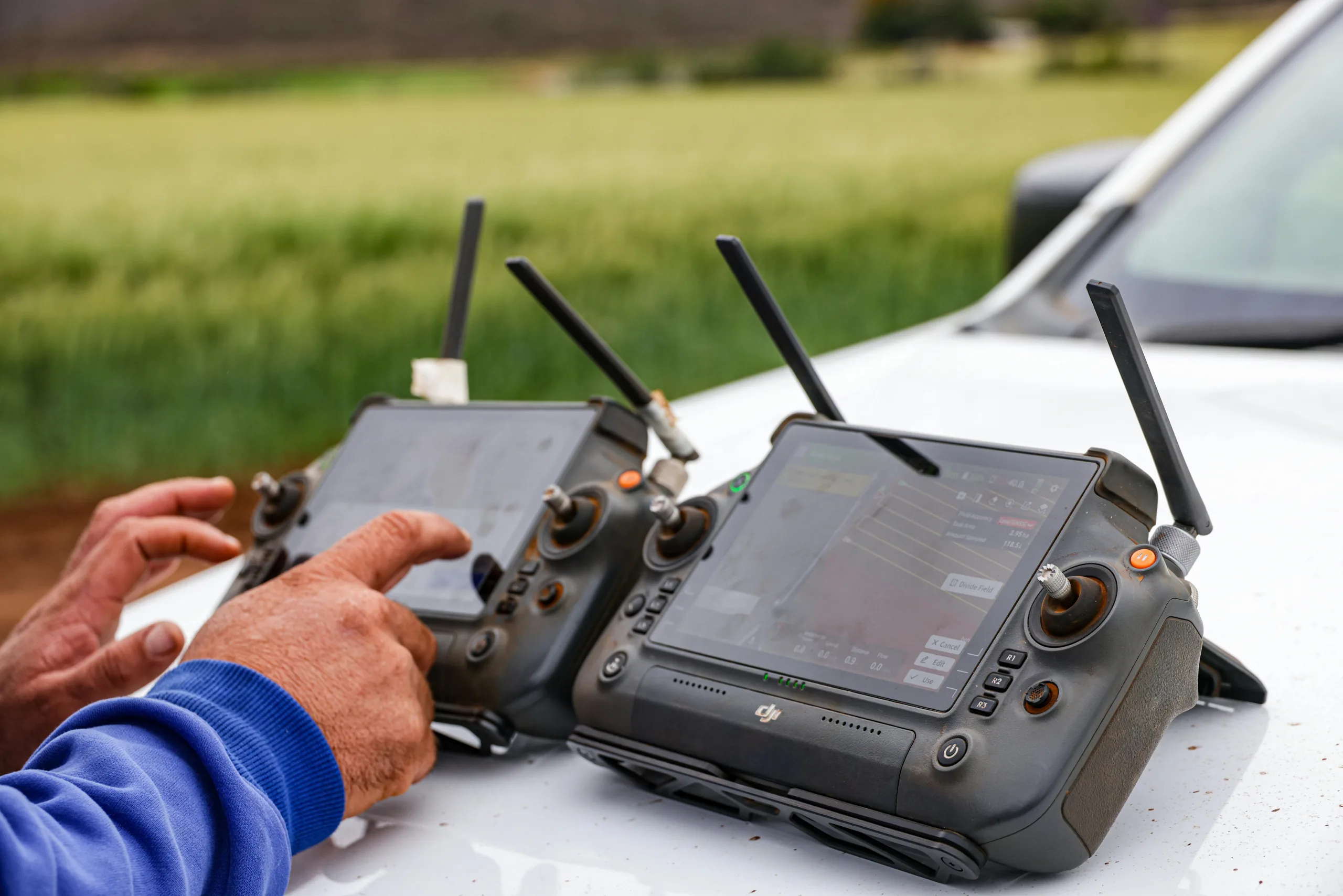
RTK / PPK Positioning
Real-time and post-processed kinematic workflows deliver centimetre-level georeferencing with minimal ground control.
Processing & Modeling Software
Industry-standard photogrammetry, point-cloud, and GIS toolchains turn raw captures into orthomosaics, 3D models, and analysis-ready datasets.
(THE TEAM)
The people behind every flight.
Fauzy Rahim
Founder & Chief Pilot
Licensed remote pilot leading flight operations and client engagements. [Placeholder bio.]
Eddie Alfred
Head of Survey & GIS
Oversees data processing, mapping accuracy, and GIS deliverables. [Placeholder bio.]
Farhan
Inspection Lead
Specialises in structural and oil & gas aerial inspection programmes. [Placeholder bio.]
Full Name
Operations Manager
Coordinates scheduling, safety compliance, and client communication. [Placeholder bio.]
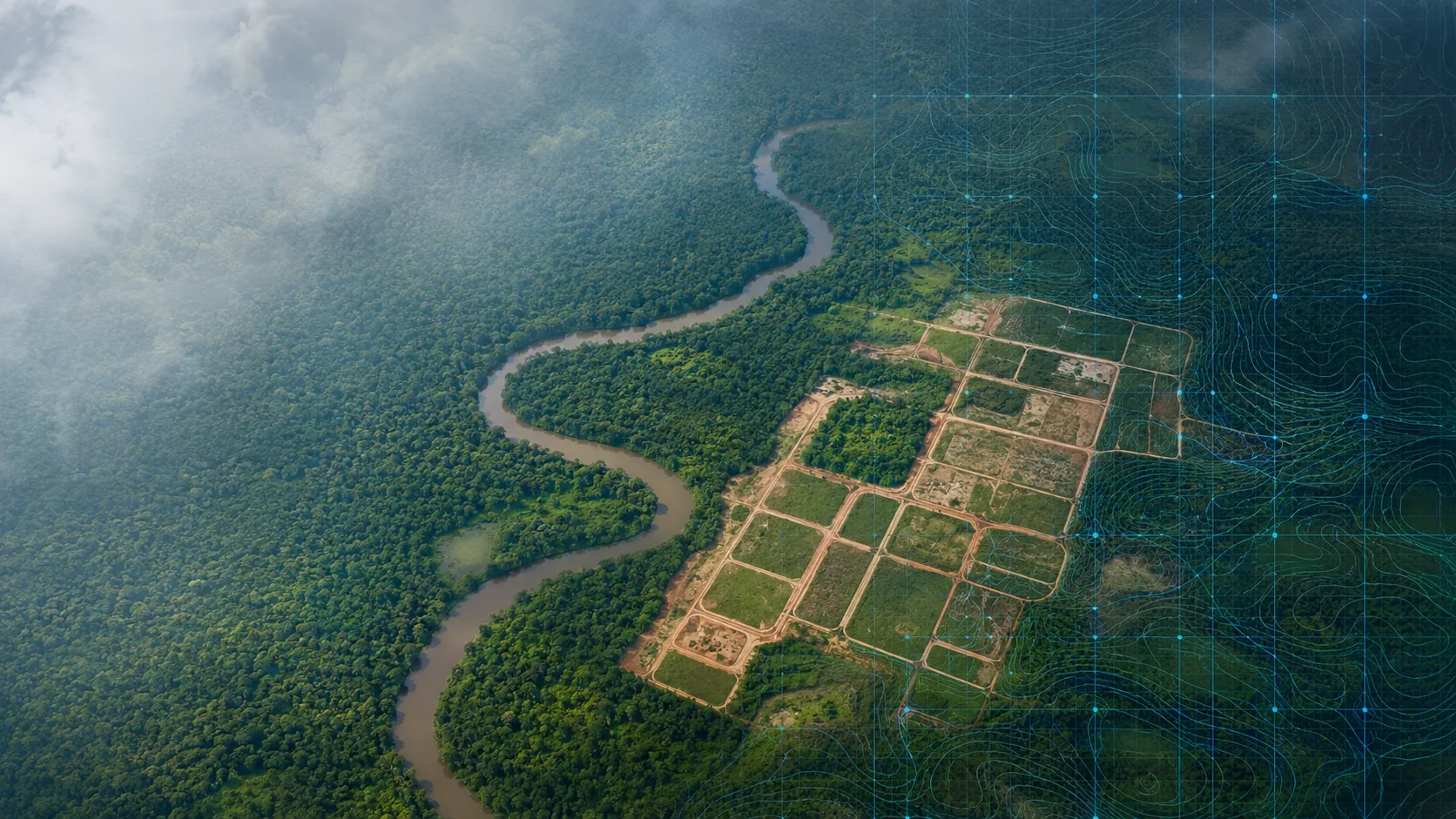
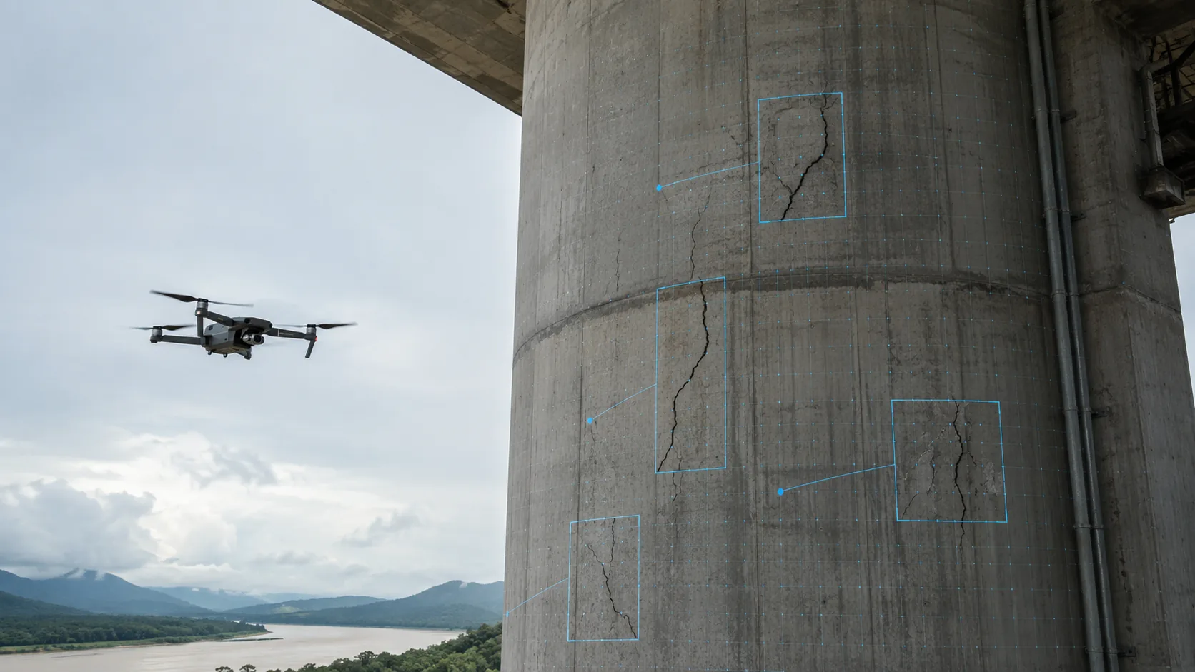
(INDUSTRIES WE SERVE)
Trusted across Borneo's most demanding sectors.
Construction
Site progress tracking, earthwork volumes, and as-built documentation.
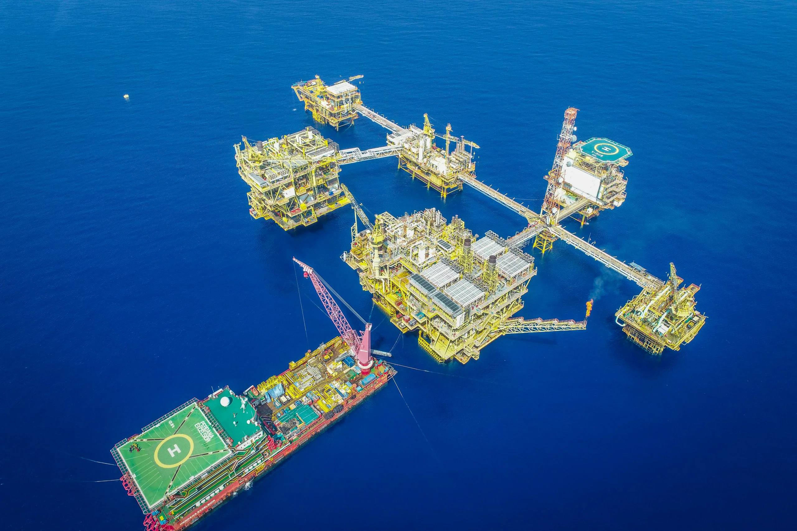
Oil & Gas
Flare stack, pipeline, and facility inspection without shutdown risk.
Infrastructure
Roads, bridges, and utilities mapped and monitored from the air.
Plantation & Agriculture
Crop health, boundary mapping, and large-area survey across estates.
Mining & Quarrying
Stockpile volumetrics, pit surveys, and rehabilitation monitoring.
Government & Planning
Land-use mapping and spatial data for planning and compliance.