GIS Analysis
O4 SERVICES
(SCROLL DOWN)
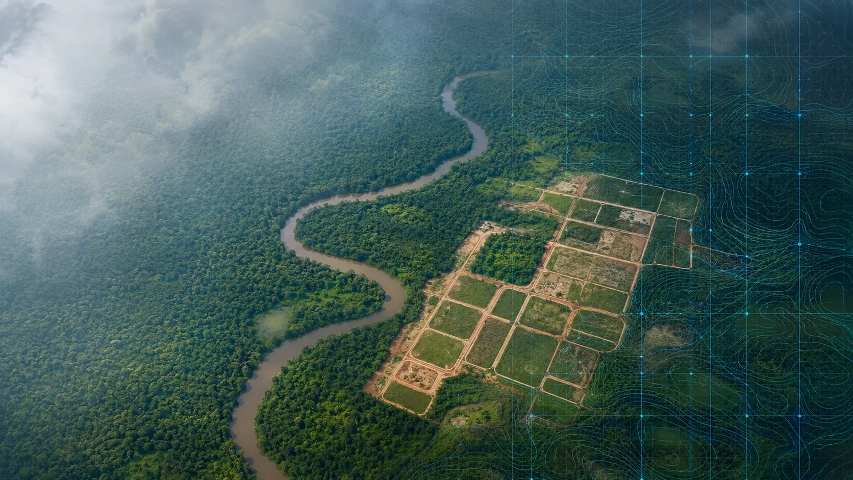
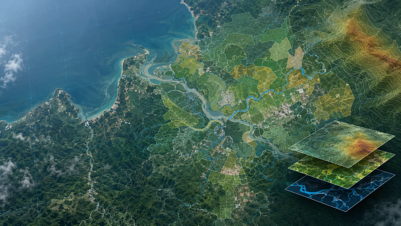
Our Geographic Information System (GIS) analysis services transform raw aerial data into actionable intelligence. We provide comprehensive spatial analysis, data visualization, and geospatial insights that support strategic planning and informed decision-making across various industries.
From environmental monitoring to urban planning, our GIS solutions integrate multiple data layers to reveal patterns, relationships, and trends that drive efficient resource management and optimal project outcomes.

SPATIAL ANALYSIS
Advanced geospatial analytics to identify patterns and relationships across locations

TERRAIN MODELING
Digital elevation models and 3D terrain visualization for planning and analysis

LAND USE MAPPING
Classification and analysis of land cover types for resource management

DATA INTEGRATION
Seamless integration of multiple data layers for comprehensive spatial intelligence

ENVIRONMENTAL ANALYSIS
Environmental impact assessment and monitoring using geospatial data
WATERSHED ANALYSIS
Hydrological modeling and watershed delineation for water resource management

VEGETATION MAPPING
Multispectral analysis to map and monitor vegetation health and distribution

NETWORK ANALYSIS
Optimization of routes and networks for transportation and utility planning